


Practical Application of GIS Tools – Applied Exercises
Synopsis
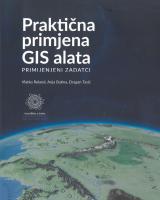
Practical Application of GIS Tools – Applied Exercises, by Vlatko Roland, Anja Batina and Dragan Tasić, is a practice-oriented university handbook introducing readers to geographic information systems (GIS) and their application, intended for students, educators, professionals in technical and natural sciences, GIS enthusiasts, and anyone wishing to acquire or improve practical skills in working with spatial data. Combining theoretical explanations with hands-on exercises, the handbook covers GIS fundamentals, spatial data formats and sources, symbology and classification, spatial data editing and analysis, as well as map creation, visualization and export, with practical procedures presented in parallel using Esri ArcMap and QGIS. A distinctive feature of the handbook is its use of cartographic data from Tolkien’s Middle Earth, enabling readers to develop essential GIS skills step by step and bring their acquired knowledge together by independently creating and visualizing a GIS map. The handbook is published as an open-access resource under the Creative Commons Attribution 4.0 International (CC BY) license.
Downloads
Download data is not yet available.
References
Downloads
Published
August 19, 2026
Copyright (c) 2026 Vlatko Roland, Anja Batina, Dragan Tasić
Details about this monograph
ISBN-13 (15)
978-953-331-634-5
How to Cite
Roland, V., Batina, A., & Tasić, D. (2026). Practical Application of GIS Tools – Applied Exercises. Morepress Books. https://doi.org/10.15291/9789533316345


